Category:Pendine Sands
Jump to navigation
Jump to search

beach in Carmarthenshire, Wales  | |||||
| Upload media | |||||
| Instance of | |||||
|---|---|---|---|---|---|
| Location |
| ||||
 | |||||
Deutsch: Pendine Sands ist ein Uferstreifen an der walisischen Küste, der in den 1920er Jahren als Strecke für Rekordversuche mit de:Rennwagen verwendet wurde.
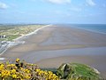
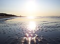
English: Pendine Sands is a length of beach on the shores of Carmarthen Bay on the south coast of Wales. It stretches from Gilman Point in the west to Laugharne Sands in the east. The village of Pendine is close to the western end of Pendine Sands.
Nederlands: Pendine Sands is een 11¼ km (7 mijl) lang strand aan de kust van de baai van Carmarthen aan de zuidkust van Wales. Het strekt zich uit van Gilman Point in het westen tot aan Laugherne Sands in het oosten. Het dorp Pendine is gesitueerd nabij het westelijke einde van Pendine Sands.
Subcategories
This category has only the following subcategory.
M
Media in category "Pendine Sands"
The following 47 files are in this category, out of 47 total.
-
 A little way below the mapped low water mark - geograph.org.uk - 5419534.jpg 2,122 × 1,591; 483 KB
-
 Along the beach near low water - geograph.org.uk - 5419545.jpg 2,448 × 1,836; 714 KB
-
 Beach at Pendine - geograph.org.uk - 363779.jpg 640 × 480; 54 KB
-
 Beach Hotel, Tenby.jpg 3,264 × 2,448; 2.16 MB
-
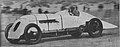
 Blue Bird, Pendine, January 1927 (Our Generation, 1938).jpg 2,620 × 859; 602 KB
-
 Cycling at the beach, Pendine, South Wales (17273852855).jpg 4,224 × 2,816; 1.36 MB
-
 Daft Dog paddles in the surf - geograph.org.uk - 5419553.jpg 2,285 × 1,714; 533 KB
-
 Freedom on the beach at Pendine - geograph.org.uk - 5419537.jpg 2,285 × 1,714; 566 KB
-
 Land speed record attempt at Pendine Sands (17203098201).jpg 3,874 × 2,583; 935 KB
-
 Malcolm Campbell, Pendine, January 1927 (Our Generation, 1938).jpg 2,454 × 1,168; 662 KB
-
 Near the low water mark - geograph.org.uk - 5419548.jpg 2,285 × 1,714; 560 KB
-

-
 Parry Thomas and Babs, Pendine, April 1926 (Our Generation, 1938).jpg 2,360 × 931; 495 KB
-
 Pendine Sands (35666817025).jpg 5,111 × 2,465; 6.36 MB
-
 Pendine Sands (5705).jpg 4,288 × 2,848; 4.94 MB
-
 Pendine Sands (5708).jpg 4,288 × 2,848; 5.04 MB
-
 Pendine Sands (5709).jpg 4,288 × 2,848; 4.38 MB
-
 Pendine Sands (5710).jpg 4,288 × 2,848; 4.65 MB
-
 Pendine Sands (5711).jpg 4,288 × 2,848; 4.88 MB
-
 Pendine Sands (5713).jpg 4,288 × 2,848; 4.88 MB
-
 Pendine Sands (5714).jpg 4,288 × 2,848; 4.52 MB
-
 Pendine Sands (5715).jpg 4,288 × 2,848; 4.46 MB
-
 Pendine Sands (5717).jpg 4,288 × 2,848; 4.66 MB
-
 Pendine Sands (5718).jpg 4,288 × 2,848; 3.72 MB
-
 Pendine Sands (5719).jpg 4,288 × 2,848; 3.66 MB
-
 Pendine Sands (5720).jpg 4,288 × 2,848; 5.88 MB
-
 Pendine Sands (5721).jpg 4,288 × 2,848; 4.45 MB
-
 Pendine Sands (5722).jpg 4,288 × 2,848; 6.65 MB
-
 Pendine Sands (5724).jpg 4,288 × 2,848; 5.82 MB
-
 Pendine Sands (5725).jpg 4,288 × 2,848; 3.98 MB
-
 Pendine Sands (5729).jpg 4,288 × 2,848; 6.05 MB
-
 Pendine Sands (5733).jpg 4,288 × 2,848; 3.69 MB
-
 Pendine Sands (5734).jpg 4,288 × 2,848; 5.31 MB
-
 Pendine Sands (5737).jpg 4,288 × 2,848; 5.16 MB
-
 Pendine Sands (5738).jpg 4,288 × 2,848; 5.34 MB
-
 Pendine Sands (5740).jpg 4,288 × 2,848; 4.71 MB
-
 Pendine Sands (5741).jpg 4,288 × 2,848; 4.76 MB
-
 Pendine Sands - geograph.org.uk - 144333.jpg 640 × 580; 279 KB
-
 Pendine Sands - geograph.org.uk - 188696.jpg 640 × 480; 68 KB
-
 Pendine Sands in September 2008.jpg 2,032 × 1,515; 472 KB
-
 Pendine Sands Sunrise 29-09-2008.jpg 2,032 × 1,524; 501 KB
-
 Receding tide on Pendine Sands - geograph.org.uk - 5419542.jpg 2,285 × 1,714; 633 KB
-
 Sunbeam 350HP 'Bluebird'.jpg 5,184 × 2,307; 942 KB
-

-
 Tide in what a beach Pendine - panoramio.jpg 2,048 × 1,536; 694 KB
-
 Welsh TT races Trophy.jpg 480 × 640; 70 KB
-


.jpg)


.jpg)
.jpg)


.jpg)
.jpg)
.jpg)
.jpg)
.jpg)
.jpg)
.jpg)
.jpg)
.jpg)
.jpg)
.jpg)
.jpg)
.jpg)
.jpg)
.jpg)
.jpg)
.jpg)
.jpg)
.jpg)
.jpg)
.jpg)
.jpg)
.jpg)
.jpg)


.jpg)
.jpg)